Understand the land
Organise parcel boundaries, management history and relevant soil, climate and satellite evidence. Show data gaps and uncertainty.
 Agro Capital StandardCARBON
EUROPE FIRST · GLOBAL AMBITION
Climate, satellite and soil data for agricultural carbon projects, from field assessment to independent verification.
Programme in development
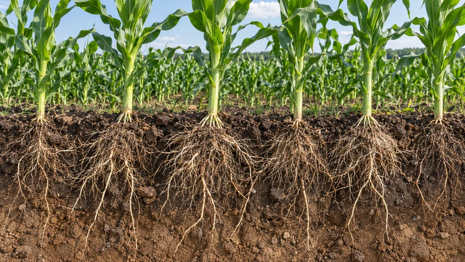
CARBON IN AGRICULTURE
Plants connect the atmosphere with the soil. A carbon project documents what changes, where it changes and how the result is measured.
Plants take up CO₂ from the atmosphere to grow.
Roots and plant residues contribute carbon to the soil.
Samples and monitoring help assess changes in soil carbon.
The net climate result depends on carbon inputs, losses and the baseline. FAO · Soil organic matter
01 / OUR APPROACH
A structured path from land assessment to a documented carbon project.
Organise parcel boundaries, management history and relevant soil, climate and satellite evidence. Show data gaps and uncertainty.
Assess eligibility, baseline and additionality. Design monitoring and reporting around the requirements of the selected programme.
Maintain traceable evidence and responsibilities for independent verification.
FARMER INCOME
Agro Capital Standard’s indicative range: €10–40 per hectare per harvest year. Your farm’s amount is determined after a preliminary assessment and agreement on project terms.
Assess my farmPayment depends on project eligibility, changes in farming practices, verified climate results and certificate sales. The range is not guaranteed: payment may be zero. Farm-specific costs are assessed separately.
DATA FOUNDATION
The shared ACS catalogue brings together climate, satellite, soil and agricultural data. Coverage is assessed by country, period, resolution and permitted use.
Explore the ACS data catalogue
Metrics
Temperature, rainfall, soil moisture; derived drought, heat, frost and growing-degree indicators.
Global reanalysis for historical climate context at regional scale.
Metrics
Surface reflectance, NDVI, vegetation seasonality and usable observation coverage.
Vegetation monitoring with cloud and shadow filtering.
Metrics
Soil organic carbon, pH, texture and bulk density.
Global soil estimates at 250 m, complemented by project sampling.
Metrics
Yield, production, harvested area and agricultural time series.
Country and regional benchmarks for agricultural analysis.
Metrics
Parcel boundaries, land rights, rotations, inputs, soil samples and practice changes.
A project-specific evidence base, collected with permission.
Data retain their source, date, units, resolution, uncertainty and terms of use.
COMPUTATION
Google Cloud supports data analysis in BigQuery and application services in Cloud Run. European processing region: europe-west1.
Distributed queries over historical datasets and geospatial records.
Managed compute for APIs, analytical services and scheduled processing.
Processing capacity and access are configured for each service.
02 / THE EVIDENCE PATH
MRV brings together measurement, reporting and verification, from the baseline to independent review.
Boundaries, land rights, history and an eligible activity.
A credible baseline, sampling and suitable models.
Document practice changes, observations and uncertainty.
Independent review before any claim of certified outcomes.
03 / WHO IT IS FOR
Understand the evidence, obligations and costs a potential project would require.
Assess project assumptions, evidence and economic risks.
Explore coordinated agricultural programmes with clearly defined accountability.
04 / WHERE WE BEGIN
Europe is the first launch region, with international expansion planned.
Explore the European approachPROJECT QUALITY
Define what would happen without the project and why the claimed change is additional.
Quantify uncertainty, consider reversal risk and document monitoring obligations.
Record land and benefit rights, evidence provenance and controls against double counting.
Qualified independent bodies verify results under the selected programme, supported by traceable measurements and documented models.
JURISDICTIONS
Each programme follows the requirements of the country where work takes place. Project agreements define the contracting entity, scope, applicable law and dispute jurisdiction.
EU and national requirements for data protection, land rights and carbon certification.
Moldovan legislation, local agreements and applicable international programmes.
Country-specific data, methodological and operational assessment before launch.
REGIONAL PRESENCE
Registered group base in Dondușeni.
Representation planned.
Representation planned.
International expansion planned.
Enter the country, region, area, crops and email in the request form. Farming practices, land tenure and previous-season records help refine the preliminary assessment.
Measured and verified results, monitoring and verification costs, and the agreed commercial terms.
Qualified independent verifiers under the chosen carbon programme. The operator prepares the data and project documentation.
OWNERSHIP & DELIVERY
Parent company · brand and proprietary IP owner
Holds the Agro Capital Standard brand and the group’s proprietary technology rights; provides strategic governance and owns 100% of TF INTELLIGENCE PLATFORM S.R.L.
Technology operator · service delivery company
Develops the platform, manages data, integrates technology and delivers contracted services.
PRELIMINARY ASSESSMENT
Share your farm’s key details. We will review the potential for a carbon project and clarify the scope and service price before any contract.