Assess the project
Review field boundaries, land rights, farming history and proposed practice changes. Identify eligibility requirements and the evidence needed for the next decision.
 Agro Capital StandardCARBON
CARBON SERVICES / EUROPE
We assess agricultural land across Europe, within and beyond the EU. ACS and TerraScore tools, climate, satellite and soil data, and farm records support a substantiated document package for independent review.
Land assessment · Data analysis · Project documentation
Services
We define the work around your land, available records and the requirements of a suitable carbon programme.
Review field boundaries, land rights, farming history and proposed practice changes. Identify eligibility requirements and the evidence needed for the next decision.
Bring together farm records, soil analyses, climate and satellite observations. Document the baseline, assumptions and monitoring requirements.
Assemble the project description, analytical annexes and evidence register into a coherent dossier for the client and independent reviewer.
ACS · Agro Capital Standard
CARBON is part of Agro Capital Standard (ACS). A shared data environment connects land, climate, farm and agricultural market information. We select the sources and tools each project needs and assemble the results into reviewable documentation.
LandPassport structures evidence about a location: land boundaries and identity, climate history, soil and vegetation context. Sources, observation periods and the basis of each conclusion remain visible in the report.
For a carbon project, it supports the initial assessment: what is known about the land, what supports it and which field measurements are needed. Regional models and satellite observations are considered alongside farm records and soil samples.
ECOSYSTEM TOOLS
Farm information
Fields, crops, rotations and work history provide context for gathering source records and documenting agricultural practices.
Climate and risk
Climate series, seasonal conditions and early signals of change help identify risks that need attention.
Evidence provenance
Technologies for recording sources, versions and events support checks on record integrity and the history of evidence handling.
AI action governance
Controls for permitted sources and actions, draft preparation and approval of operations requiring a human decision.
Workflow coordination
Management of tasks, context and participant authority when working with data and analytical materials.
Institutional analysis
Presentation of agricultural data and evidence for bank or investor review. Financial decisions remain with the relevant institution.
Tools, access and data exchange are selected for the task and agreed scope. The project package contains selected, reviewed materials with their sources.
Field boundaries, farm history and permitted sources.
Locations, dates, units and observation quality.
The baseline, calculations and measurement plan.
The project description, annexes and evidence register.
FARMER INCOME
Agro Capital Standard’s indicative range: € 10 – 40 per hectare per harvest year. Your farm’s amount is determined after a preliminary assessment and agreement on project terms.
Assess my farmPayment depends on project eligibility, changes in farming practices, verified climate results and certificate sales. The range is not guaranteed: payment may be zero. Farm-specific costs are assessed separately.
YOUR PROJECT DOSSIER
The document package is tailored to the agreed service and programme. It brings the project narrative, data and supporting evidence together in six parts.
Field maps and areas, participants, land-use rights, project period and responsibilities.
Management history, reference scenario, selected methodology and justification of additionality.
Data sources and dates, field records, soil reports, satellite and climate extracts, with links to supporting material.
Methods, inputs, results, uncertainty and the distinction between measured and modelled values.
Indicators, sampling requirements, observation frequency, responsible parties and reporting schedule.
Evidence checklist, issues to resolve, benefit rights, double-counting controls and agreed commercial responsibilities.
CARBON prepares the assessment and documentation. Qualified independent bodies assess verification and certification under the selected programme; issuance and sales follow its rules and the project agreements.
Scope your document packageHOW WE PROCESS DATA
Project evidence is organised by field and observation period. Measurements, model estimates and calculated indicators remain clearly identified.
Record field identifiers, boundaries, area and land rights. Collect crop rotations, yields, tillage, fertilisers, residues and available soil reports with the required permissions.
Check completeness, dates, units and geographic relevance. Match records to field boundaries and seasons; flag duplicates, inconsistencies and observations affected by clouds.
Combine suitable climate, satellite and soil information with management records. Record the baseline, calculation method, assumptions and uncertainty; list any additional measurements required.
Review the analysis against its supporting evidence. Organise source references, calculation versions, responsibilities and outstanding requests before assembling the project dossier.
Satellite indicators and regional soil maps support assessment. Field measurements and laboratory analyses follow the requirements of the selected methodology.
DATA SCALE AND COMPOSITION
The ACS database combines large historical datasets with individual farm evidence: climate, Earth observation, soils, agricultural statistics, market indicators and land records. Record count is one measure; precision, time coverage and fitness for the project matter for every dataset.
Temperature, rainfall and moisture; analysis of drought, heat, frost and seasonal conditions.
Reanalysis supplies climate context for a location. The report identifies the period, grid and derived indicators.
Sentinel-2, vegetation indices, seasonal dynamics and Copernicus land surface data.
Cloud cover, acquisition dates and usable observations are considered. Satellite indices help plan monitoring.
Organic carbon, pH, texture and bulk density, together with farm soil samples.
SoilGrids supplies modelled context at 250 m resolution. Sampling and laboratory results substantiate parcel characteristics.
Yields, production and areas: FAOSTAT, USDA NASS for the US and IBGE SIDRA for Brazil.
National and regional series help compare farm history with the broader agricultural context.
World Bank Pink Sheet commodity benchmarks and exchange rate series from the ECB, NBM and NBU.
Economic scenarios retain the period, currency and source. Commodity prices are not carbon certificate prices.
Boundaries, land rights, field logs, fertilisers, residues, rotations and measurement results.
Records are supplied with the necessary access rights; versions and parcel links are retained in the evidence register.
Each dataset records its source, date, geography, resolution, units, quality and usage terms. Modelled estimates, actual measurements and client information are identified separately.
EUROPE AND GLOBAL MARKETS
ACS connects the European agricultural context with international sources. Project assessment relates global observations to national statistics, local records and the selected programme.
We consider projects across the EU, including Romania, Italy, France, Germany, Spain and Poland. Data is selected by country, crop and season.
Moldova and Ukraine, the United Kingdom, Switzerland, Norway and other European countries, considering local sources, land rights and project conditions.
International agricultural context: climate, farming statistics and markets. Dedicated national sources support analysis for the US and Brazil.
Global source coverage and parcel analysis availability differ. For each country, we confirm the required layers, their currency, usage rights and project requirements; the contract defines the service scope.
CARBON IN AGRICULTURE
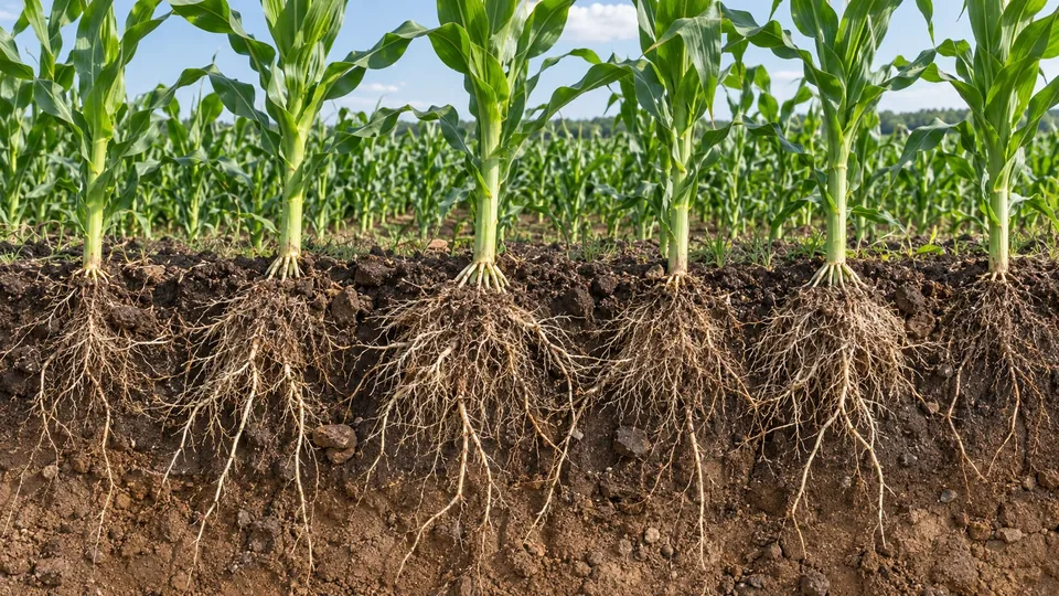
Plants connect the atmosphere with the soil. A carbon project documents what changes, where it changes and how the result is measured.
Plants take up CO₂ from the atmosphere to grow.
Roots and plant residues contribute carbon to the soil.
Samples and monitoring help assess changes in soil carbon.
The net climate result depends on carbon inputs, losses and the baseline. FAO · Soil organic matter
COMPUTATION
Google Cloud supports data analysis in BigQuery and application services in Cloud Run. European processing region: europe-west1.
Distributed queries over historical datasets and geospatial records.
Managed compute for APIs, analytical services and scheduled processing.
Processing capacity and access are configured for each service.
PROJECT QUALITY
Define what would happen without the project and why the claimed change is additional.
Quantify uncertainty, consider reversal risk and document monitoring obligations.
Record land and benefit rights, evidence provenance and controls against double counting.
Qualified independent bodies verify results under the selected programme, supported by traceable measurements and documented models.
Enter the country, region, area, crops and email in the request form. Farming practices, land tenure and previous-season records help refine the preliminary assessment.
Measured and verified results, monitoring and verification costs, and the agreed commercial terms.
Qualified independent verifiers under the chosen carbon programme. The operator prepares the data and project documentation.
International cooperation
Published EEN technology cooperation profiles of the group companies.
TF Intelligence Platform S.R.L.
Earth observation, climate, soil and data provenance brought together for land assessment and agricultural risk analysis.
TOMD20261001007
View EEN profileTF HOLDING S.R.L.
Human-governed artificial intelligence, data provenance and reviewable evidence for decisions and execution.
TOMD20260929009
View EEN profileOWNERSHIP & DELIVERY
Parent company · brand and proprietary IP owner
Holds the Agro Capital Standard brand and the group’s proprietary technology rights; provides strategic governance and owns 100% of TF INTELLIGENCE PLATFORM S.R.L.
Technology operator · service delivery company
Develops the platform, manages data, integrates technology and delivers contracted services.
PRELIMINARY ASSESSMENT
Tell us the location, area and crops. We will review the available information and agree the scope, required documents, timetable and service price before contracting.